Subject: Lima, Peru; Native Americans
Period: 1683-1754 (circa)
Publication:
Color: Hand Color
A. Plan Scenographique de la Cite des Rois ou Lima Capitale du Royaume de Perou, by Jacques Nicolas Bellin, from Prevost's Histoire Generale des Voyages ... Tome Treizieme, published 1756 (12.6 x 7.8"). This intricate copper-engraved plan shows the fortified city of Lima, the capital of Peru. The key at right locates 70 features on the map, including cathedrals, universities and colleges, monasteries, hotels, and more. Condition: There are two small wormholes in the bottom corners of the image that have been infilled with archival materials, with minute loss of image.
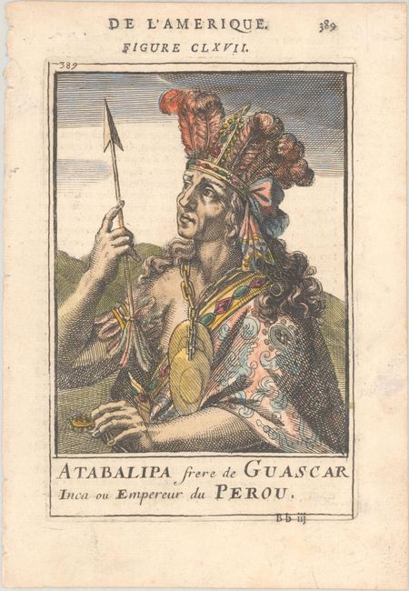
B. Atabalipa Frere de Guascar Inca ou Empereur du Perou, by Alain Manesson Mallet, from Description de l'Univers, circa 1683 (4.2 x 6.1"). A lovely small portrait of Atahualpa (also known as Atabalipa), who was the last ruler of the Incas. He wears a feathered headdress and holds an arrow. French text on verso. Reference: King (2nd ed.) pp. 152-53; Pastoureau, MANESSON-MALLET 1 A [674]. Condition: A crisp impression with a tiny hole in the image and marginal soiling.
References:
Condition: A
See description above.