Subject: Ancient World
Period: 1652 (published)
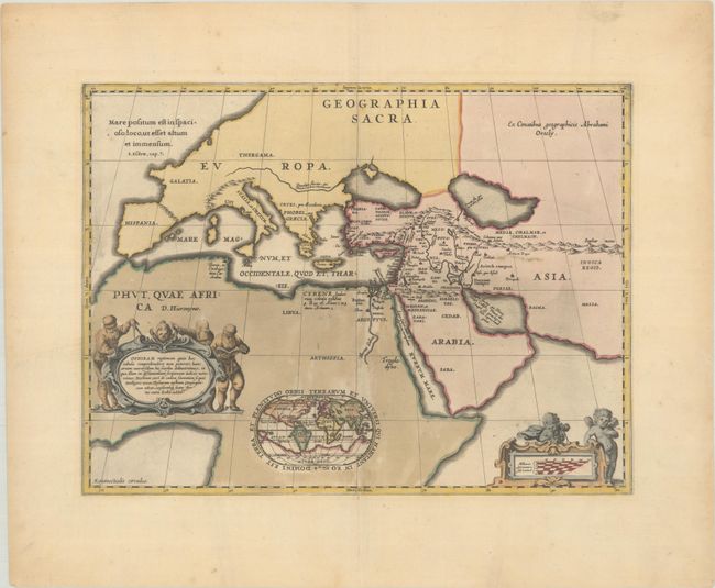
Publication: Accuratissima Orbis Antiqui Delineatio
Color: Hand Color
Size:
18.8 x 14.1 inches
47.8 x 35.8 cm
This map is based on the nearly identical map of the same title by Ortelius. It depicts the world known to the ancients and is based on the Old and New Testament, following the translation of the Septuaginata. Inset into the map is a small (4 x 2.5") modern world map on an oval projection. The sheet is decorated with a cartouche flanked by geographers and a scale of miles with two cherubs. The cartouche contains text describing Ophir, the mythical land where Solomon got the gold to build his famous temple in Jerusalem. The world map shows the mythical Ophir in four possible locations; Southeast Asia, South Africa, the West Indies and South America. Blank verso.
References: Van der Krogt (Vol. I) #0810H:1.
Condition: B+
A dark impression with contemporary color in the map and later color in the two cartouches. There is light printer's ink residue, and the map has been professionally backed in archival tissue to repair cracks along the green outline of Africa.