Subject: Atlantic Ocean
Period: 1680 (circa)
Publication:
Color: Black & White
Size:
20.7 x 16.6 inches
52.6 x 42.2 cm
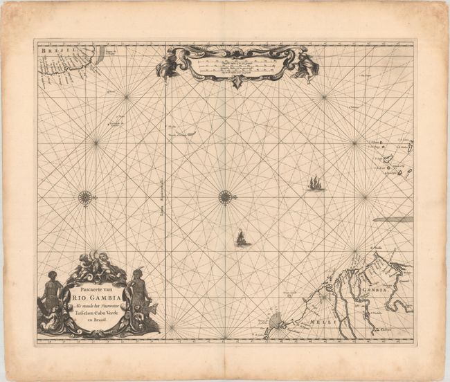
This rare and elegantly engraved sea chart depicts the passage across the Atlantic from Western Africa to Brazil. It shows the African coast spanning from the mouth of the Senegal River to the mouth of the Sierra Leone. The Gambia River valley and Cap-Vert peninsula are prominently shown. The Cape Verde islands are located as well. The Atlantic is crisscrossed by rhumb lines, with two sailing ships heading from Africa towards Brazil. The Brazilian coast includes several place names, including Paraiba oste Fredrick Stadt, Fort Orange, the Dutch settlement on Itamaraca, and Villa de Olinda de Penambuco. An elaborate figurative title cartouche appears at bottom left, and at top the distance scales are contained in an ornate strapwork cartouche flanked by putti. Two compass roses capped with fleurs-de-lis orient north to the right. The chart appeared in multiple atlases by Goos, Robijn, and Roggeveen.
References: cf. Koeman, Rob 4 & Rog 12; cf. Shirley (BL Atlases) M.GOOS-2h.
Condition: B+
A sharp impression on a sturdy sheet with a few light spots and printer's ink residue. There are light dampstains confined to the sheet's edges.