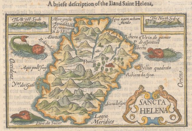
Subject: Saint Helena Island
Period: 1598 (published)
Publication: His Discours of Voyages Into ye Easte & West Indies...
Color: Hand Color
Size:
4.9 x 3.1 inches
12.4 x 7.9 cm
This charming small map of Saint Helena was published in the English translation of Jan Juygen van Linschoten's Itinerario. Saint Helena was an important stopover for ships trading between Europe and Africa or Asia. Adapted from the Barent Langenes miniature map that first appeared in his Caert-Thresoor (1598), the map depicts the island with pictorial renderings of its rugged topography and two tiny inset views of coastal approaches on the west and north side. Three sea monsters and a decorative cartouche embellish the tiny map. On a sheet of English text measuring 7.0 x 11.6".
References: Shirley (BL Atlases) G.LIN-2a #11.
Condition: B+
There is light foxing and marginal creasing and soiling.