Subject: Europe
Period: 1702 (circa)
Publication: Nouvelle Metode pour Aprende Facilement et sans Maitre la Geografie
Color: Hand Color
Size:
18.1 x 16.6 inches
46 x 42.2 cm
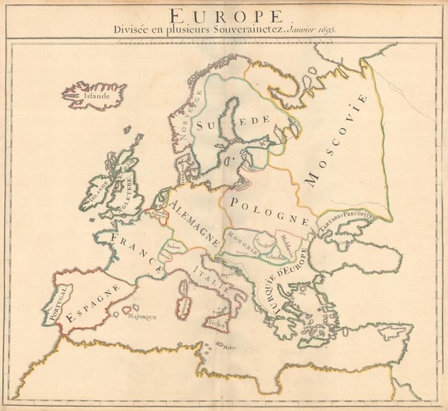
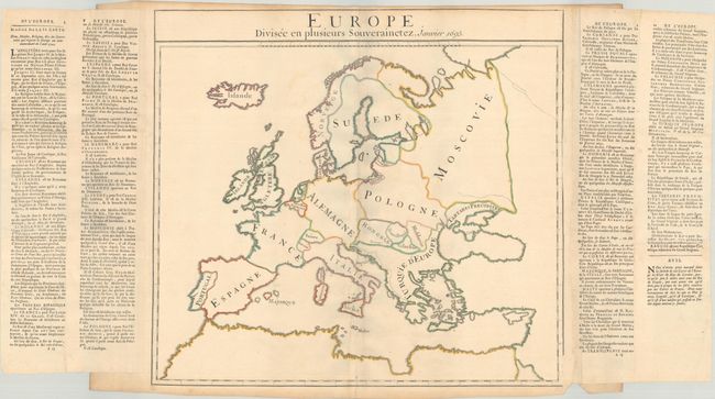
This simple outline map of Europe was created by Louis Dangeau and used multiple times in his geography book to depict various concepts, such as bodies of water, different countries, capitals, etc. Nomenclature was often added to each version in manuscript, sometimes using stencils, and explanatory text was printed on separate sheets and pasted onto the sides of the maps. This version presents the various political entities in Europe at the beginning of 1702, with some of the country names engraved on the plate and some added in manuscript. The columns of explanatory text on the sides of the sheet discuss the political leaders and religion for each country shown on the map. A very uncommon map. The full sheet with French text measures 31.2 x 17.2".
References: Rumsey #3658.
Condition: B+
A nice impression with contemporary outline color, issued folding on a sheet with a bunch of grapes watermark. There is minor offsetting, a few spots of foxing, a chip at bottom right, and light toning along the edges of the sheet.