Subject: Europe, Solar Eclipse
Period: 1710 (circa)
Publication:
Color: Hand Color
Size:
22.6 x 19.4 inches
57.4 x 49.3 cm
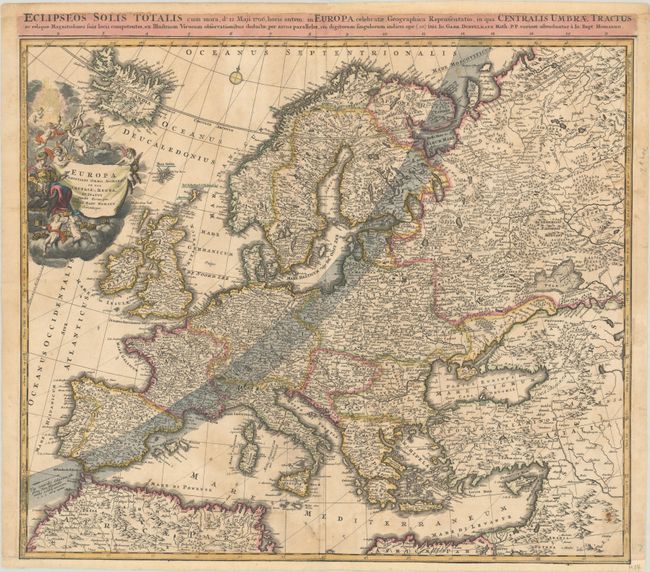
This map depicts the path of the solar eclipse that traveled across Europe on May 12, 1706. The central path of the eclipse is marked with dotted lines adjacent to the arrow at bottom left, running through Spain, France, Germany, Poland, and beyond. The map also illustrates the Christian kingdoms in Europe and is characteristically filled with details. The large title cartouche features a personification of Europa surrounded by adorable putti nestled in the clouds. There is an alternate title above the map, printed from a different plate: "Eclipseos Solis Totalis cum Mora, d. 12 Maji 1706, Horis Antem: in Europa Celebratae, Geographica Repraesentatio..."
References:
Condition: B
A nice impression with faint dampstains, light soiling, a bit of cockling of the paper, and two 1.5" tears adjacent to the centerfold that have been repaired with old paper on verso. Remargined at bottom with part of the neatline replaced in facsimile, and the top margin has been extended with a minor amount of the title above the map replaced in facsimile.