Subject: Britain
Period: 1750 (circa)
Publication:
Color: Hand Color
Size:
22.3 x 19 inches
56.6 x 48.3 cm
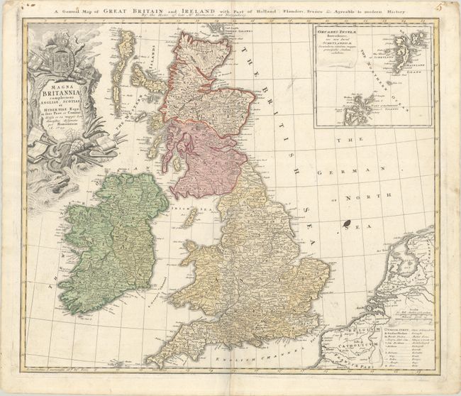
This handsome and uncommon map of the British Isles is filled with details on provinces, towns, and counties, with the Orkney Islands included in an inset at upper right. A table at the lower right includes symbols for cities, market towns, bishoprics, roads, ferries and bogs, among other places of note. The richly decorated title cartouche is topped with the crest of Britain. There is a second English title above the map, A General Map of Great Britain and Ireland with Part of Holland, Flanders, France &c. Agreeable to Modern History.
References:
Condition: B+
Contemporary color on a bright sheet of watermarked paper. There is an archivally repaired 2.75" centerfold separation at bottom and a small ink stain in the North Sea. Minor soiling is mostly in the blank margins.