Catalog Archive
Auction 202, Lot 367

"The Isle of Man Exactly Described, and Into Several Parishshes Divided, with Every Towne, Village, Baye, Creke, and River Therein Conteyned...", Speed, John

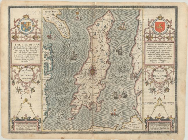
Subject: Isle of Man

Period: 1676 (circa)

Publication: The Theatre of the Empire of Great Britaine

Color: Hand Color

Size:
19.9 x 15.1 inches
50.5 x 38.4 cm
Download High Resolution Image
(or just click on image to launch the Zoom viewer)

A highly decorative map depicting the Isle of Man in the Irish Sea, extending to show partial coastlines of Ireland, Scotland, England and Wales. It is based on Durham's earlier map of 1595 as mentioned on the plate. The map is lavishly illustrated by four cartouches, a compass rose centered on the island, numerous ships in a fully stippled sea, and sea monsters being ridden by figures holding various flags. Includes the imprint of Bassett and Chiswell indicating the map was published around 1676 (dated 1610). English text on verso.

References: Shirley (BL Atlases) T.SPE-1j.

Condition: B+

A nice impression with archival reinforcement along the centerfold to repair a few small fold separations and one tiny hole. There are some minor spots in the image and several short archivally repaired edge tears.

Estimate: $700 - $850

Sold for: $500

Closed on 2/12/2025

Archived