Subject: Northern England
Period: 1662 (circa)
Publication: Toonneel des Aerdrycks oft Nieuwe Atlas ... Vierde Deel
Color: Hand Color
Size:
19.7 x 15 inches
50 x 38.1 cm
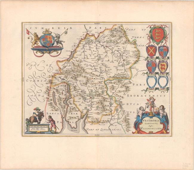
This attractive map of Westmorland is based on John Speed's prior map. It is filled with place names and topographical detail, including scores of tiny, fenced compounds shown across the map with names like Brigster Park, Colnhead Park, Crosbye, and Midleton. Windermere is called Wynandermere, near the Wynander Mere flud (now called Windermere Lake). The map is highly adorned with a royal coat of arms, a scale of miles surrounded by surveyors, a title cartouche topped with putti and six coats of arms, with two being left blank. Dutch text on verso, published between 1648-62.
References: Van der Krogt (Vol. II) #5380:2.
Condition: A
A dark impression with full contemporary color on a bright sheet with a large watermark of the god Atlas. There is a small paper flaw along the border at right and light toning and soiling along the top edge of the sheet.