Subject: Southern England
Period: 1695 (circa)
Publication: Camden's Britannia
Color: Hand Color
Size:
16.6 x 14.1 inches
42.2 x 35.8 cm
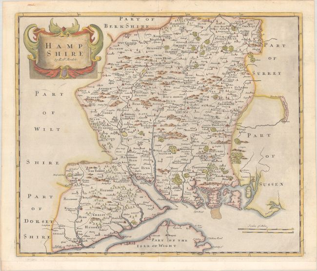
This county map of Hampshire presents the early road system, with the towns of Southampton and Portsmouth located in the lower section of the image. The map displays interesting detail including numerous hundreds, forests, rivers, bridges and parks. There is a decorative title cartouche and two distance scales.
Morden was one of the first English cartographers to show longitudes measured from the meridian of St. Paul's Cathedral (shown in degrees at the bottom of the map) and time in minutes measure locally from the sun (shown at the top in Roman numerals). The roads on his maps are based on Ogilby's earlier survey. The Britannia was first published by historian William Camden (1551-1623) in 1586. After the publication of the final edition of Britannia in 1637, the work was not published again until 1695 when Gibson revised and translated the text from the original Latin. He included fifty maps, mostly of the English counties, prepared by Robert Morden, replacing the outdated maps of Christopher Saxton.
References: Shirley (BL Atlases) T.CAMD-5a.
Condition: A
A nice impression with minor printer's ink residue at right. The bottom margin has been extended to better accommodate framing.