Subject: London, England
Period: 1908 (circa)
Publication:
Color: Printed Color
Size:
42.3 x 21.3 inches
107.4 x 54.1 cm
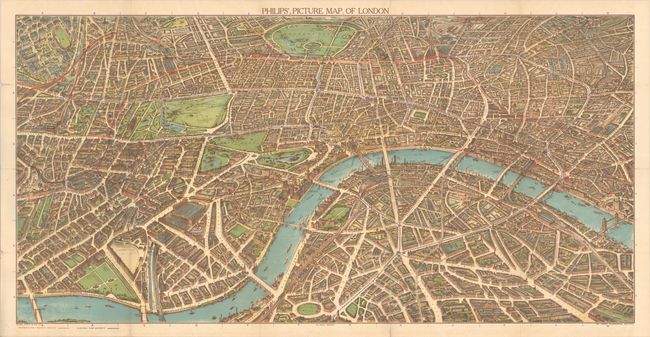
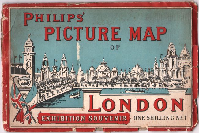
This vast and detailed panoramic bird's-eye view of London was published to coincide with the Franco-British Exhibition of 1908. It spans from the exhibition grounds near Shepherd's Bush east to the Tower Bridge. The map features intricate detail of the city, showing several sites of interest to the London visitor, including Buckingham Palace, the Palace of Westminster and Westminster Abbey, Big Ben, Trafalgar Square, the British Museum, and the Tower of London. It delineates the streets and shows the Metropolitan-District Railway in red and the London Underground railways in blue. Parks are prominently depicted, including Hyde Park, Regent's Park, and St. James Park. A later version of this map was published to coincide with the 1911 Coronation Exhibition in 1911. The Coronation Exhibition is not to be confused with the much larger Festival of Empire, which was held in the Crystal Palace, to the south of the area covered here. The map folds into illustrated stiff paper wrappers (9.3 x 6.1"), with title in English and French ("Plan Panoramique de Londres - Souvenir de l'Exposition").
References:
Condition: B+
A colorful example, issued folding, with several separations along the folds, including one that enters 3" into map image at bottom. An edge tear enters 1" into map at right. Stiff paper wrappers are chipped along the edges with minor soiling.