Subject: Northern Wales
Period: 1676 (circa)
Publication: The Theatre of the Empire of Great Britaine
Color: Hand Color
Size:
20 x 15.1 inches
50.8 x 38.4 cm
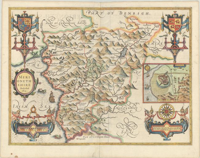
This excellent map of Merionethshire includes an inset of Harlech. The map graphically depicts the rugged countryside, which was one of the most desolate and poorest counties in Wales at the time. It is further decorated with two coats of arms, a compass rose, sea monsters, sailing ships, and a siren. The bottom corners are adorned with strapwork cartouches showing the distance scale and imprint, respectively. Includes the imprint of Bassett and Chiswell indicating the map was published around 1676 (dated 1610). English text on verso.
John Speed is best known for this important atlas of Great Britain, which is considered the finest achievement in British map-making. Speed assembled the information for this atlas based on the work of Christopher Saxton and John Norden, updated with new information. He also introduced innovations of his own including town plans, indications of the hundreds, county boundaries, and the coats of arms of local Earls and Dukes. The maps were finely engraved by Jodocus Hondius, one of the preeminent engravers of the period.
References: Shirley (BL Atlases) T.SPE-1j.
Condition: B+
A nice impression on watermarked paper with a printer's crease to the right of the distance scale cartouche. The centerfold has been reinforced on verso with what appears to be archival tape to repair a couple of tiny holes.