Subject: Western Scotland
Period: 1654 (published)
Publication: Theatrum Orbis Terrarum sive Atlas Novus Pars Quinta
Color: Hand Color
Size:
20.8 x 15.4 inches
52.8 x 39.1 cm
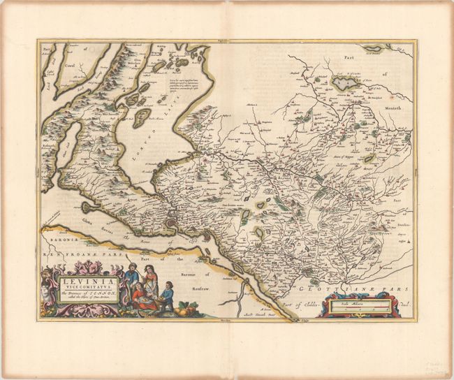
This lovely map focuses on the region just north of the Firth of Clyde, including Loch Lomond and the city of Dumbarton. The map is handsomely embellished with two strapwork cartouches figures of farmed harvesting produce. Latin text on verso.
Publication of Bleau’s atlas of Scotland (Atlas Novus, Volume V) in 1654 was a landmark publication in cartographic history. Most of the maps were based on the surveys of Timothy Pont, which had been done half a century earlier. The publication took over seven decades to bring to publication; it was delayed by wars, copyright restrictions, and only intermittent official support. The maps are scarce today due to the relatively short publication history of the atlas.
References: Van der Krogt (Vol. II) #5834:2.
Condition: B+
A sharp impression on a bright sheet with light toning along the centerfold and heavy soiling along the far edge of the sheet.