Catalog Archive
Auction 202, Lot 391

"Carte du Gouvernement Civil et Militaire avec l'Etat des Officiers du Royaume d'Irlande", Chatelain, Henry Abraham
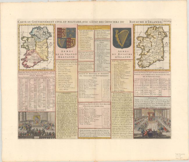
Subject: Ireland

Period: 1720 (published)

Publication: Atlas Historique, Tome II

Color: Hand Color

Size:
18.2 x 13.7 inches
46.2 x 34.8 cm
Download High Resolution Image
(or just click on image to launch the Zoom viewer)

Folio sheet containing two maps of Ireland (4.4 x 5.5"), one divided into the four provinces and the other showing the major towns in the Kingdom of Ireland. Panels of French text and several tables provide a detailed history of the civil governmental structure, including information on civil service, banks, and the legal system. The coats of arms of Great Britain and the Kingdom of Ireland are prominently displayed. At bottom are vignettes depicting the Parliament and the House of Commons of Ireland.

References:

Condition: A+

A crisp impression on a clean, bright sheet with an "IV" watermark.

Estimate: $160 - $190

Sold for: $90

Closed on 2/12/2025

Archived