Subject: North Sea, England & Low Countries
Period: 1799 (dated)
Publication:
Color: Black & White
Size:
37 x 24.9 inches
94 x 63.2 cm
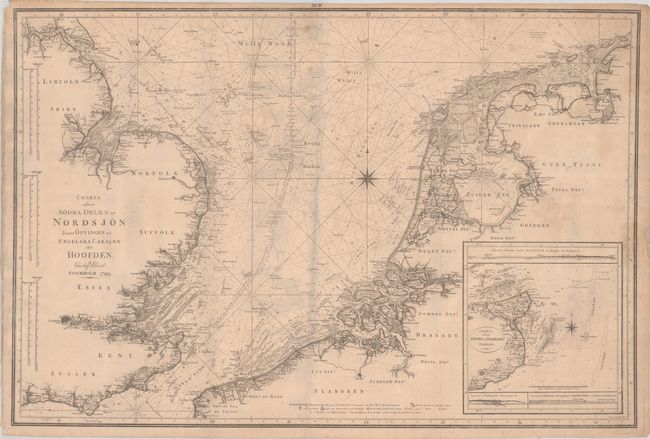
This large and uncommon Swedish chart covers the southern North Sea from London north to Hull in England and from Calais, France to beyond Groningen, Netherlands on mainland Europe. There is remarkable navigational details in the sea including soundings, shoals, banks, anchorages, bottom types, and more. The chart also features rich detail along the coastlines including many towns and villages, rivers, vegetation, topography, and offshore islands. Includes a detailed inset of the Dover coastline at bottom right. Decorated by two compass roses and six distance scales along the left border. Engraved by Fr. Akrel.
References:
Condition: B
Folded vertically by a previous owner with some minor soiling and staining. There is an old tape repair to a 1.25" edge tear at right and a few other small repaired edge tears and separations.