Subject: Southern Norway
Period: 1659 (published)
Publication: Nuevo Atlas o Teatro del Mundo...
Color: Hand Color
Size:
19.6 x 16.3 inches
49.8 x 41.4 cm
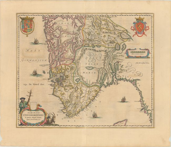
This fine map shows the Bishopric of Stavanger and the adjacent regions from the work of Laurids Clausen Scavenius, the bishop of Stavanger from 1605 to 1626. The map locates the major villages and towns and presents reasonable coastal detail. However, the interior topography is not very accurate with Opslo Tellemarck shown as a large empty region, save for a large lake and a notation describing the road from Stavanger to Hallengdal as "very hard due to the steepness of the mountains." The map is beautifully embellished with two coats of arms, four sailing ships and two fine cartouches. Spanish text on verso, published in 1659.
References: Ginsberg (Scandia) #CE51; Van der Krogt (Vol. II) #1310:2.
Condition: B+
Full contemporary color on a sheet with an elephant watermark and light offsetting. There is a centerfold separation entering 4" into map image at bottom that has been closed on verso with archival materials.