Subject: Baltic Sea
Period: 1666 (dated)
Publication: De Zee-Atlas, Ofte Water-Weereld…
Color: Hand Color
Size:
21.4 x 17.4 inches
54.4 x 44.2 cm
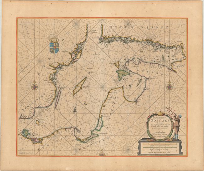
This scarce sea chart covers the Baltic Sea and extends from Rugen through the Gulf of Finland. The islands of Gotland, Bornholm, Rugen, Oland, and Oesel are delineated. Among the cities named along the coasts are Stralsund, Stockholm, Gdansk, Coningsbergen (Kaliningrad), Memel (Klaipeda), Riga, Parnu, Narva, Vyborg, and Helsinki. There are five decorative compass roses orienting the map, two of which show the deviation from magnetic north. This map is a revised version of Goos' map of the Baltic, reengraved by Gerard Coeck for the Zee Atlas. The decorative elements have been completely changed to include the arms of Sweden and the title and scale cartouche featuring a man using a cross-staff.
Pieter Goos was one of Amsterdam’s most prominent publishers of nautical charts. The reputation of his firm was matched only by that of the publishing houses of Blaeu and van Keulen, and his maritime atlas of the world was one of the most complete sea atlases published prior to the appearance of Van Keulen's Zee-Fakkel in the 1680s.
References: Koeman, Goos 1 B #4; Tooley (MCC-70) #291.
Condition: B+
Full contemporary color with gold leaf highlights on a thick sheet with light toning and foxing. Remnants of hinge tape on verso and a crease at top right.