Catalog Archive
Auction 202, Lot 404

"Carte de la Mer Baltique, Contenant les Bancs, Isles et Costes Comprises Entre l'Isle de Zelande et l'Extremite du Golfe de Finlande", Jaillot, Alexis-Hubert
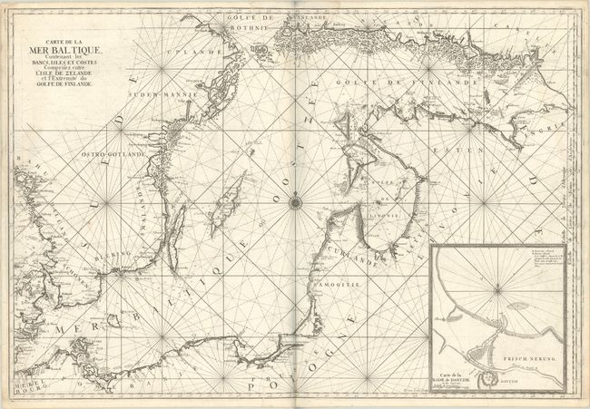
Subject: Baltic Sea

Period: 1693 (circa)

Publication: Le Neptune Francais

Color: Black & White

Size:
35.4 x 24.1 inches
89.9 x 61.2 cm
Download High Resolution Image
(or just click on image to launch the Zoom viewer)

This superb, large sea chart of the Baltic Sea is filled with detail along the coastlines including mountains, cities, and forests. A large inset depicts the harbor and entrance to the city of Dantzik (Gdansk). The map is centered on a compass rose with radiating rhumb lines. This chart was initially created for Jaillot's Neptune Francois and subsequently was incorporated into publications by Bellin for the Depot de la Marine. Engraved by Herman van Loon, whose imprint appears adjacent to the inset. An uncommon chart.

References: Pastoureau, NEPTUNE FRANCAIS A [2].

Condition: B+

A dark impression on a bright, watermarked sheet with a bit of offsetting and printer's ink residue. There is light dampstaining at top and a printer's crease at bottom center.

Estimate: $900 - $1,100

Sold for: $450

Closed on 2/12/2025

Archived