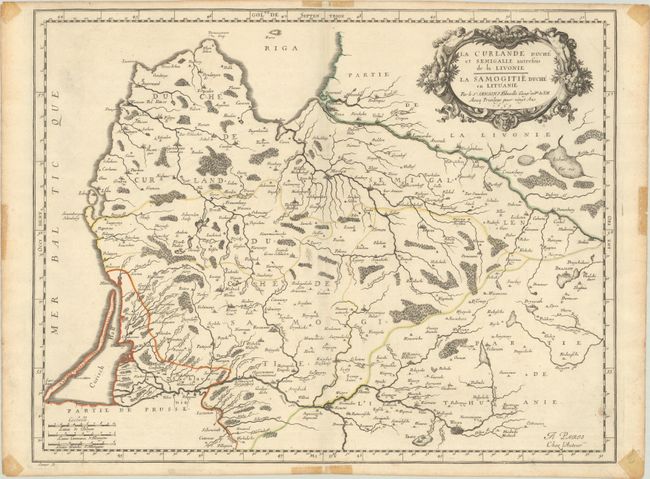
Subject: Baltic, Latvia & Lithuania
Period: 1659 (dated)
Publication: Cartes Generales de Toutes les Parties du Monde
Color: Hand Color
Size:
21.1 x 16.4 inches
53.6 x 41.7 cm
This delicately engraved map shows the historical Latvian lands of Curlande (Courland) and Semigallen (Semigallia), as well as Samogitie (Samogitia) in Lithuania. It spans from Riga south to Vilnius, and from Memel (present-day Klaipeda) east to Braslaw. The top right corner is decorated with an ornate title cartouche complete with cornucopias and putti. Three distance scales appear at bottom left. Engraved by Jean Somer.
References: Pastoureau, SANSON V B [135].
Condition: A
A fine impression with contemporary outline color on a bright sheet with a large coat of arms watermark. There is minor soiling in the map image and tape stains from a previous framing that are confined to the blank margins, not entering the map image.