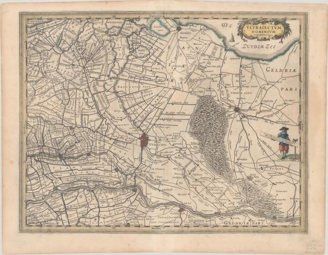
Subject: Central Netherlands
Period: 1630 (circa)
Publication:
Color: Hand Color
Size:
19.6 x 15.1 inches
49.8 x 38.4 cm
Fine map of the immediate vicinity of Utrecht and Amersfoort. The map is a fascinating look at the region during the period of dyke building and lake drainage conducting in Holland in the early 17th century. The map is covered with canals, dykes and windmills. A decorative title cartouche, sailing ship, and a costumed figure supporting the distance scale make this a very attractive sheet. Blank verso.
References: Van der Krogt (Vol. II) #3660:2.
Condition: B+
A dark impression on a bright sheet with a watermark of "WMT." There are a few spots of foxing, a faint stain at right, and light toning along the edges of the sheet.