Subject: Eastern Belgium
Period: 1643 (circa)
Publication: Theatre du Monde ou Nouvel Atlas
Color: Hand Color
Size:
19.6 x 15.1 inches
49.8 x 38.4 cm
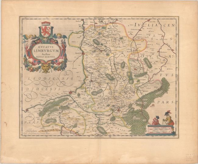
Decorative map of Belgium that is centered roughly on the Meuse River as it flows through the fortified cities of Hoy, Liege, and Maastricht. Fully engraved to show mountains, rivers, forests, cities, and villages, it extends to include Limbourg, Dalen, Tudder and, for our racing fans, Spa is at the extreme southern extent. The beautiful title cartouche is ornamented with a coat of arms and two putti. A second cartouche features two finely dressed men with dividers above a distance scale. French text on verso, published between 1643-50.
References: Van der Krogt (Vol. II) #3170:2.
Condition: B+
A dark impression with full contemporary color on a lightly toned sheet with light printer's ink residue, a few short printer's creases adjacent to the centerfold, and a few stains in the left margin.