Catalog Archive
Auction 202, Lot 438
"[On 3 Sheets] Le Cours du Rhin Depuis Worms, Jusqua a Bonne, et les Pays Adjaces [and] ... Depuis Strasbourg Jusqu'a Worms et les Pays Adjacens [and] ... au Dessus de Strasbourg, et les Pais Adjacens", Delisle/Dezauche
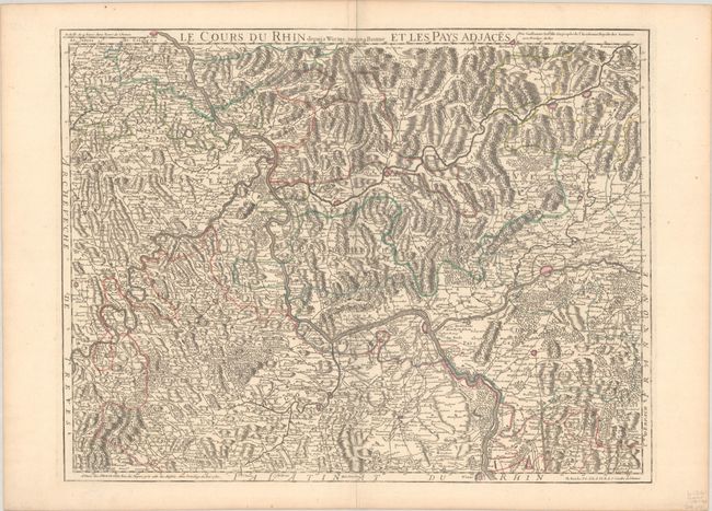
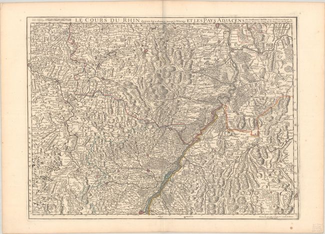
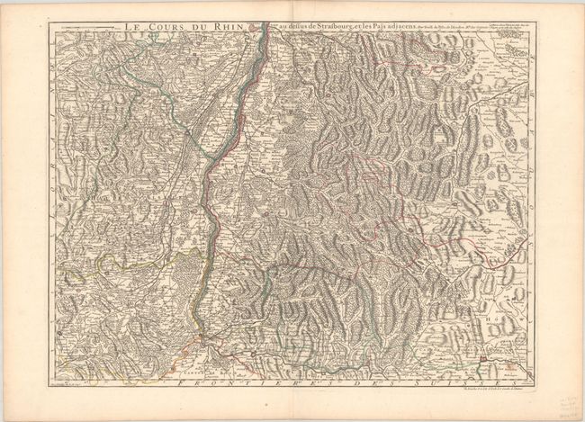
Subject: Western Europe, Rhine River
Period: 1780 (dated)
Publication:
Color: Hand Color
Size:
25.2 x 19.5 inches
64 x 49.5 cm
Download High Resolution Image
(or just click on image to launch the Zoom viewer)
(or just click on image to launch the Zoom viewer)