Subject: Western Europe, War of the Spanish Succession
Period: 1745 (circa)
Publication: Mr. Tindal's Continuation of Mr. Rapin's History of England
Color: Hand Color
This quartet of elegantly engraved battle plans chronicle notable engagements during the War of the Spanish Succession. Size varies slightly. All are engraved by James Basire.
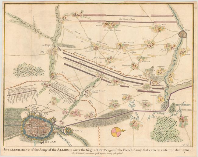
A. Intrenchment of the Army of the Allies to Cover the Siege of Douay Against the French Army, that Came to Raise It in June 1710, (18.7 x 14.2"). This plan details the siege of Douai, showing troop placements and the extensive fortifications of the city. This was one of Britain's few successes against the French in 1710. Condition: A crisp impression, issued folding, on watermarked paper with light offsetting. A top centerfold separation that extends just past the neatline and a chip in top margin have both been archivally repaired. (B+)
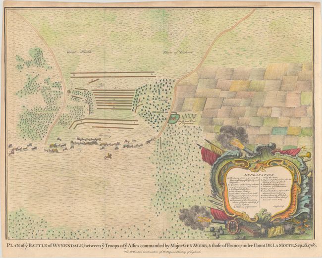
B. Plan of ye Battle of Wynendale, Between ye Troops of ye Allies Commanded by Major Gen. Webb, & Those of France, Under Count de la Motte, Sep. 28, 1708, (18.6 x 14.0"). This fine plan of the Battle of Wijnendale depicts the position of General Webb's troops in order to protect an allied convoy on its way to Lille. Wijnendale Castle is shown in the center of the plan, and an explanatory key is enclosed in a military-themed cartouche. Condition: A dark impression, issued folding, on watermarked paper with a tiny archivally repaired tear in top blank margin that just enters neatline and minor marginal toning. (A)
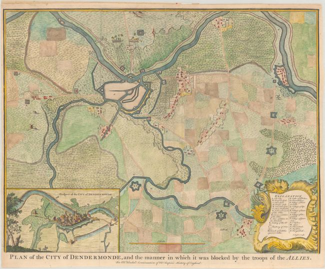
C. Plan of the City of Dendermonde, and the Manner in Which It Was Blocked by the Troops of the Allies, (18.6 x 14.4"). This excellent battle plan delineates the defenses of Dendermonde and the surrounding countryside. At the bottom is an inset plan titled Prospect of the City of Dendermonde, and an explanatory key is enclosed in an elaborate cartouche. Condition: A crisp impression, issued folding, with a top centerfold separation and a few tiny tears in top margin, some which just enter neatline, all of which have been archivally repaired. Trimmed close to neatline at left but still ample room for framing. (B+)
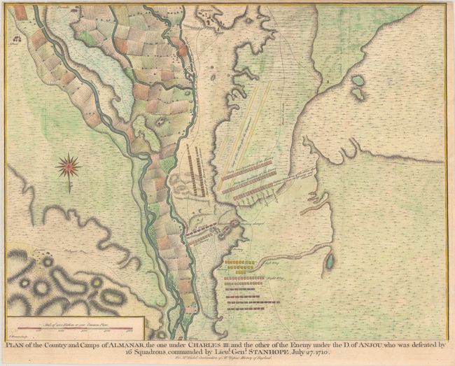
D. Plan of the Country and Camps of Almanar, the One Under Charles III and the Other of the Enemy Under the D. of Anjou, Who Was Defeated by 16 Squadrons, Commanded by Lieut. Genl. Stanhope, July 27. 1710, (18.8 x 14.3"). Detailed battle plan of the Battle of Almenar during the War of the Spanish Succession that shows troop placements with notations of movements. Condition: A sharp impression, issued folding, on watermarked paper with minor offsetting. One tiny tear in top margin just entering map image has been closed with archival tape, and top and left margins have been trimmed near neatline. (B+)
References: Shirley (BL Atlases) G.RAP-1a #14; #25; #34; & #37.
Condition:
See description above.