Catalog Archive
Auction 202, Lot 474

Map of Trade Routes

"Carta Nova Accurata del Passagio et Strada Dalli Paesi Bassi per Via de Allemagna per Italia et per Via di Paesi Suizeri a Geneva, Lione et Roma...", Wit, Frederick de

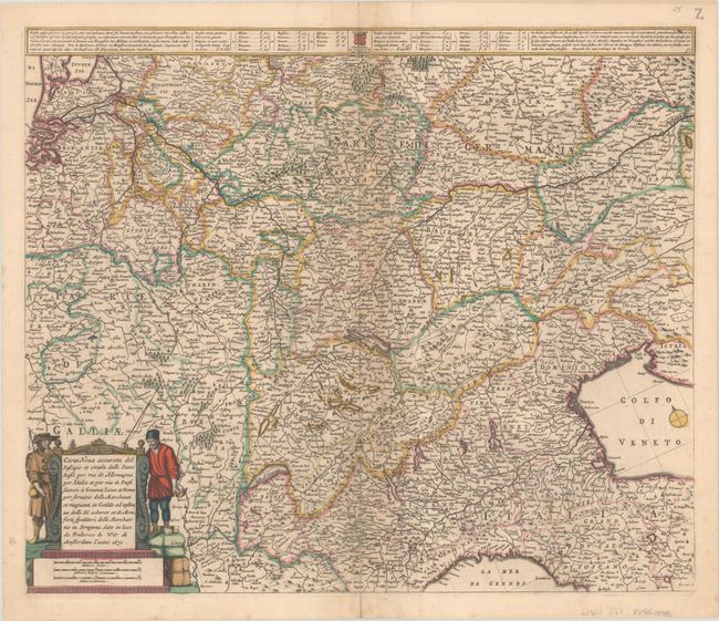
Subject: Central Europe

Period: 1671 (dated)

Publication:

Color: Hand Color

Size:
21.7 x 18.3 inches
55.1 x 46.5 cm
Download High Resolution Image
(or just click on image to launch the Zoom viewer)

This map was created to show the roads and trade routes between the Netherlands and Italy and extends from the North Sea to the Gulf of Venice. The tables at top list the prices to transport a bale between various cities. This is the fourth state, with the addition of two figures flanking the title cartouche. Although the first state of this plate bears the imprint of Cornelis Danckerts I, Carhart theorizes that the plate may have actually been engraved by De Wit.

References: Carhart #48.4.

Condition: B+

A nice impression with full contemporary color, light toning along the centerfold, minor soiling, and a centerfold separation that enters 3.5" into image at bottom and has been repaired on verso.

Estimate: $350 - $425

Sold for: $180

Closed on 2/12/2025

Archived