Subject: Central Europe
Period: 1716 (circa)
Publication:
Color: Hand Color
Size:
22.3 x 19.2 inches
56.6 x 48.8 cm
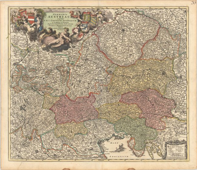
This large and boldly engraved map is centered on Salzburg and covers present-day Czech Republic, Slovakia, Hungary, Bavaria and Austria. It extends from Strasburg east to beyond Vienna and from above Prague to the Adriatic and Venice. There is good detail throughout including mountains, watersheds, roads, villages and towns, and several fortified cities including Milan, Strasburg, Nurnberg, Prague, and Vienna. The large and very decorative allegorical cartouche is adorned with cherubs, figures, and eight coats of arms. At lower right is a second cartouche with a legend and distance scales.
References:
Condition: A
A sharp impression on a sturdy, bright sheet with contemporary color in the map and later color in the title cartouche. There is a printer's crease at bottom left, a tiny hole in the title cartouche, and two small dampstains in the bottom margin, well away from the image.