Catalog Archive
Auction 202, Lot 477

"Le Royaume de Boheme, le Duche de Silesie, et les Marquisats de Moravie et Lusace, Dresses d'Apres les Cartes de Muller", Robert de Vaugondy, Gilles

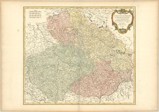
Subject: Czech Republic, Slovakia & Southern Poland

Period: 1751 (dated)

Publication: Atlas Universel

Color: Hand Color

Size:
21.8 x 19 inches
55.4 x 48.3 cm
Download High Resolution Image
(or just click on image to launch the Zoom viewer)

The first state of this delicately engraved map covers the heart of Europe, the former duchies of Bohemia, Silesia, Moravia and Lusatia. Based on the cartography of Johann Muller, the map is focused roughly on Konigsgratz (Konigingratz), and extends to include Slovakia, the southwestern part of Poland, and the eastern part of Germany. The map is filled with detail, including towns both large and small and topography. A splendid cartouche decorates the top right of the map.

References: Pedley #285.

Condition: A

A crisp impression on a bright sheet with a small birdhouse watermark and light toning along the edges.

Estimate: $140 - $170

Sold for: $100

Closed on 2/12/2025

Archived