Subject: Moon
Period: 1967 (dated)
Publication:
Color: Printed Color
Size:
26.5 x 17.3 inches
67.3 x 43.9 cm
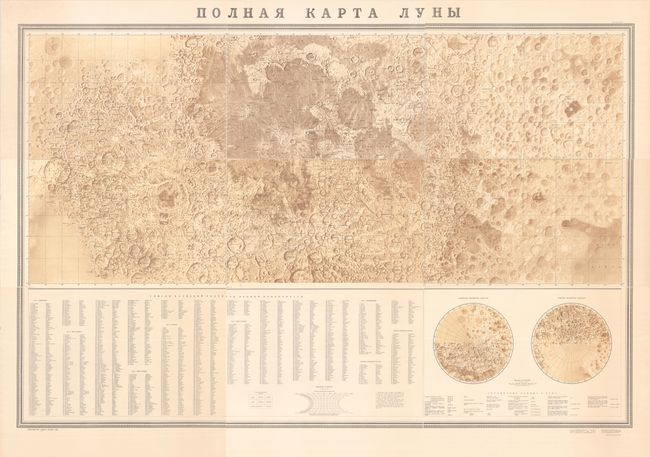
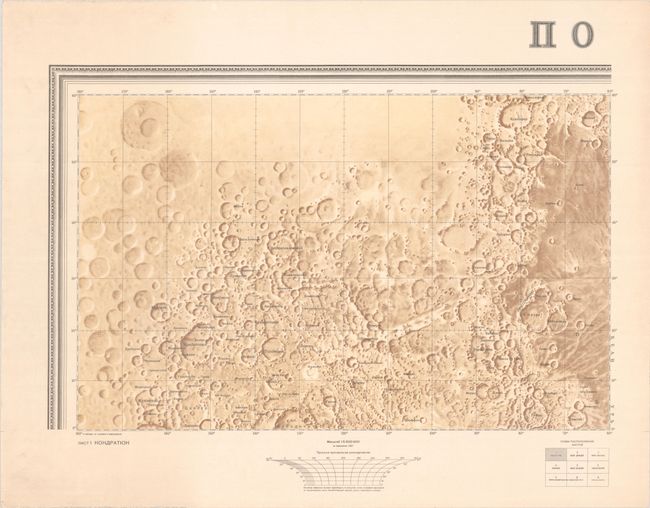
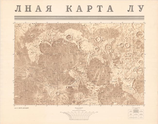
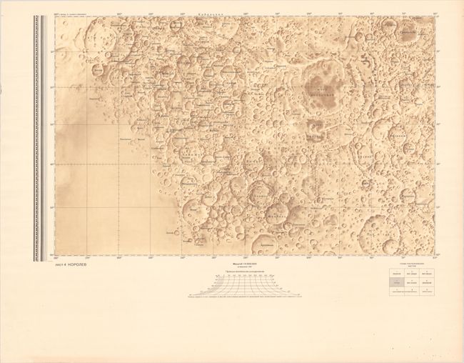
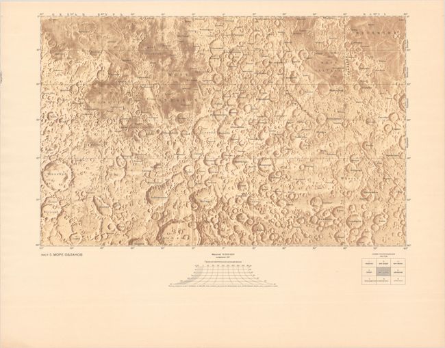
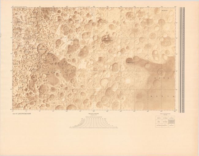
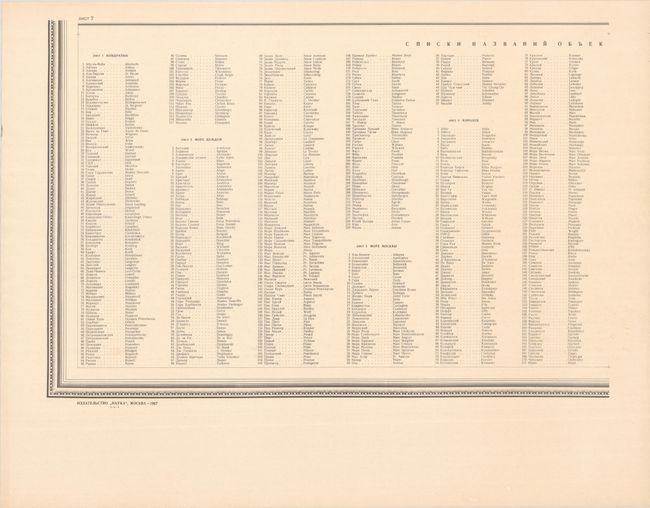
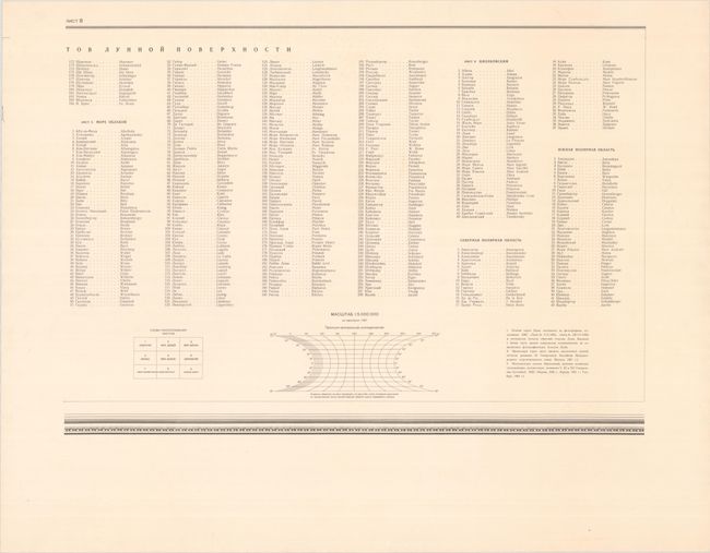
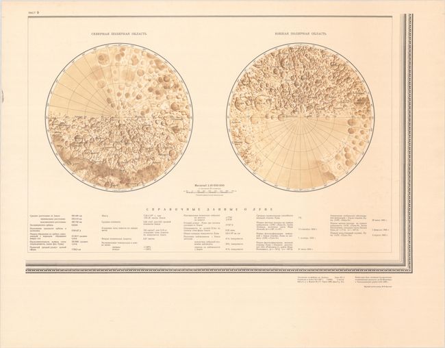
This remarkable 9-sheet map of the moon was drawn on a cylindrical projection and compiled by the Russian Sternberg Astronomical Institute for the International Congress of Astronomical Union in Prague. The first six sheets present rectangular sections of the entire moon, with an place name index (in both Russian and English) and polar projection below the main map image. The map was constructed from photographic imagery taken during two previous Soviet lunar missions including Luna 3 (1959) and Zond 3 (1965) and is both highly detailed and accurate, even by today's standards. Numerous craters are named and identified in fine detail, though the dark side of the moon still shows large blank areas (as there was limited imagery on that side). A few of the large craters include J. Herschel, Endymion, Babbage, and De La Rue. Statistics at bottom (sheet 9) include distance between the Earth and moon (384,400 kilometers), percentage of the moon's surface observed from Earth (59%), and surface temperate range (from a high of 130℃ to a low of -150℃). As the United States and the Soviet Union were still competing at this time to have the first manned mission to the moon, understanding surface temperature would have been particularly important for success. This remarkable map was updated with new information in 1969 (mapping 95% of the moon) with later editions published in 1974, 1979, 1984 and 1989. We found no past sales records for this map in the last 40 years or institutional examples on OCLC.
References:
Condition: A
Mostly clean and bright with a bit of faint dampstaining along the right side of sheet 7 (index) and 9 (polar projection). The first image is a composite image - the map is in 9 separate sheets.