Subject: Northern Germany
Period: 1680 (circa)
Publication: The English Atlas
Color: Hand Color
Size:
17.4 x 16.2 inches
44.2 x 41.1 cm
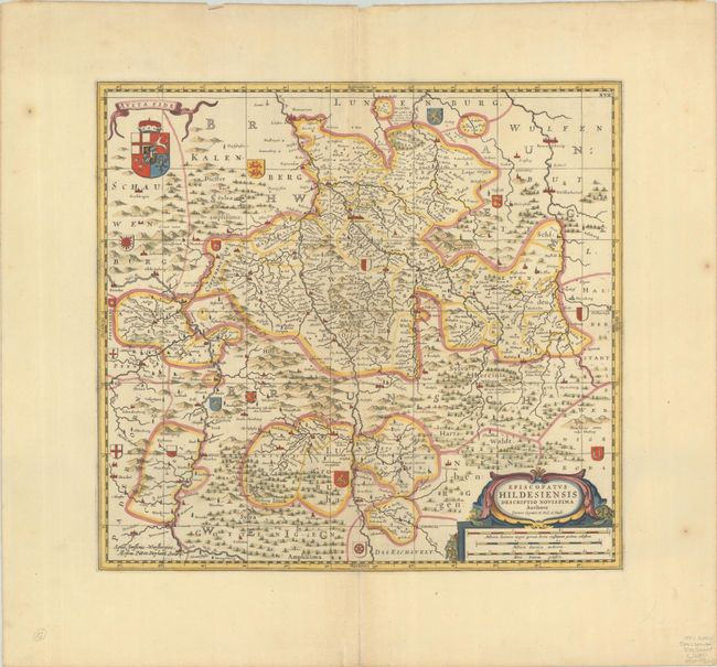
Decorative map of the region between Hannover and Northeim, and between Rinteln and Braunschweig. The map is fully engraved to show the forests, mountains, rivers and towns with numerous heralds throughout the map. Further embellished with a large coat of arms and strapwork title cartouche that incorporates the distance scale. Blank verso.
The map was published in the second volume of The English Atlas. It includes the number "XVII" at top right and a graticule that were not present on previous Jansson editions. The atlas was projected to be a 12-volume work in the tradition of the earlier Dutch atlases and was to use updated copperplates belonging to Johannes Jansson van Waesberge, son-in-law and heir of Jan Jansson. Only 4 volumes were completed before the venture failed and Pitt was thrown into debtor's prison.
References: Shirley (BL Atlases) T.PITT-1a #61; Van der Krogt (Vol. I) 2270:1.2.
Condition: A
A crisp impression on a bright sheet with a Pieter van de Ley watermark and a centerfold separation in the bottom margin that has been closed on verso with archival tape. There are a few tiny tears along the edges of the sheet.