Subject: Western Germany
Period: 1640 (circa)
Publication: Theatrum Orbis Terrarum
Color: Hand Color
Size:
19.4 x 15 inches
49.3 x 38.1 cm
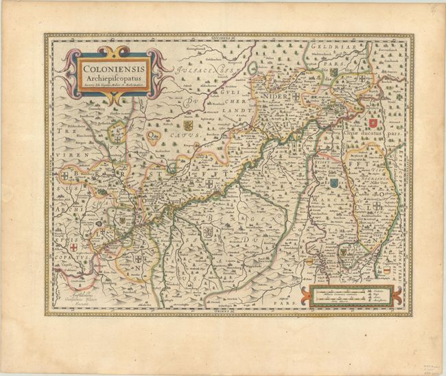
Striking map of the Rhine River valley in Westphalia was originally produced by Joannes Gigas (Gigante) for Jodocus Hondius shortly before his death. This plate was among the 39 Hondius copper plates that were purchased by Willem Blaeu in 1629. He replaced Hondius' imprint with his own and published them as part of his first atlas. The river bisects the map diagonally with Koblentz at the bottom left corner and Wesel in the upper right. The map has many small coats-of-arms locating the gentry in the area. The map is decorated with two strapwork cartouches. Latin text on verso, published between 1640-55.
References: Van der Krogt (Vol. II) #2410:2.3.
Condition: A
Excellent impression with full contemporary color on a sheet with a hint of toning and a minor dampstain in the bottom margin.