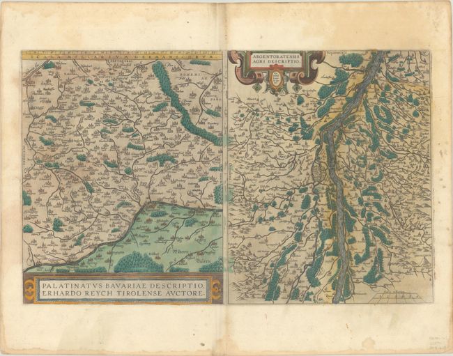
Subject: Southern Germany
Period: 1587 (published)
Publication: Theatrum Orbis Terrarum
Color: Hand Color
Size:
19.2 x 11.9 inches
48.8 x 30.2 cm
Two attractive maps on a folio sheet, each with their own strapwork cartouches, beautifully engraved by Frans Hogenberg. Both maps have charming pictorial depictions of cities and topography. Ortelius' map of Bayern (Bavariae) is based on the map by Erhart Reich. It is roughly centered on Amberg and extends to Nurnberg and Regensberg. The second map is centered on the city of Strasbourg and follows the Rhine River. This map is based on Daniel Specklin's three-sheet map of the Elsas published in 1576. Each map measures 9.5 x 12". French text on verso.
References: Van den Broecke #112.
Condition: B+
Full contemporary color on a sheet with a watermark of the coat of arms of Claude Denise. There are small stains along the centerfold, and light dampstains along the edges of the sheet.