Catalog Archive
Auction 202, Lot 505
"La Prusse, Suivant les Nouvelles Observations de Messrs. de l'Academie Royale des Sciences, Etc. Augmentees de Nouveau", Aa, Pieter van der
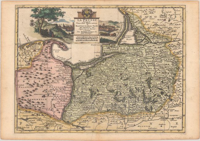
Subject: Northern Poland
Period: 1729 (published)
Publication:
Color: Hand Color
Size:
11.8 x 8.9 inches
30 x 22.6 cm
Download High Resolution Image
(or just click on image to launch the Zoom viewer)
(or just click on image to launch the Zoom viewer)