Subject: Southern Poland
Period: 1748 (dated)
Publication:
Color: Hand Color
Size:
30.6 x 17.1 inches
77.7 x 43.4 cm
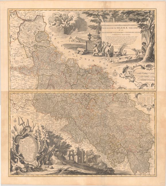
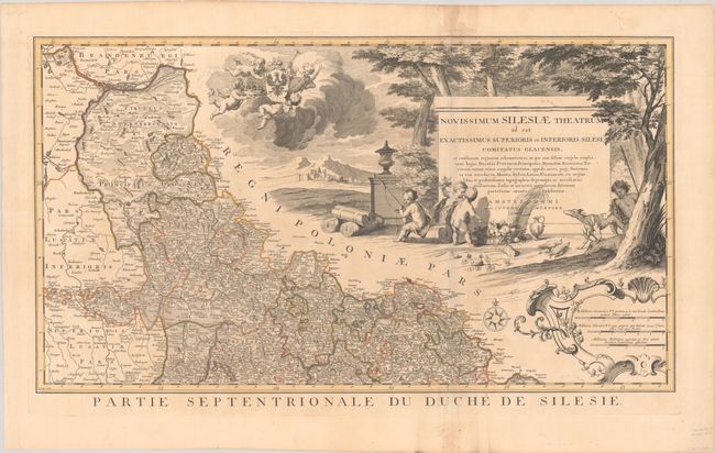
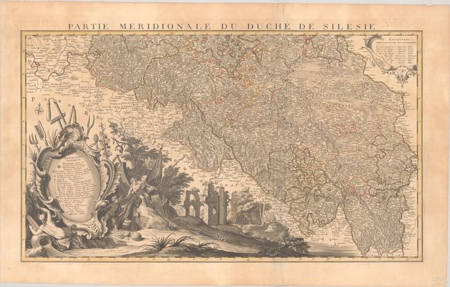
This rare two-sheet map of the historical region of Silesia is filled with detail and decorative flourishes. It is based on the map of Johann Jakob Lidl (1696-1771). Centered on Breslau (Wroclaw), it names numerous towns and cities. The map delineates duchies and features excellent topographical detail. It extends to show small portions of Germany and the Czech Republic. The northern sheet is dominated by a massive title cartouche featuring an elaborate vignette with putti, the Silesian coat of arms, and symbols of the region's bounty. There is a strapwork distance scale cartouche at bottom right. The southern sheet includes a key enclosed in an ornate cartouche surrounded by another gorgeous large-scale allegorical vignette that represents, at least in part, the vitality of the Oder River. Another smaller key explaining abbreviations appears in a cartouche at top right. Both sheets include a compass rose. Engraved by Condet.
References:
Condition: B+
A sharp impression with contemporary outline color on sturdy paper with a "C. & I. Honig" watermark. There is light dampstaining, a bit of extraneous creasing along the folds, and a couple of short fold separations confined to the blank margins. The first image is a composite image - the map is in two separate sheets.