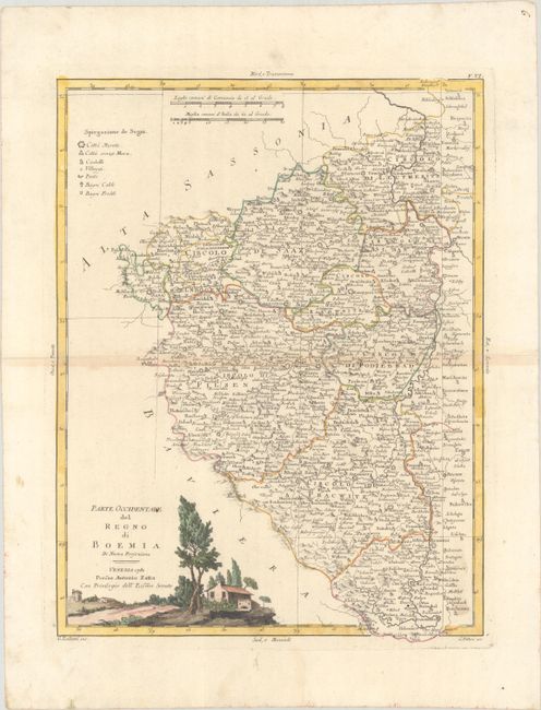
Subject: Western Czech Republic
Period: 1780 (dated)
Publication:
Color: Hand Color
Size:
12.2 x 16.1 inches
31 x 40.9 cm
This is the western half of a two sheet map covering Bohemia with the region divided into circolos (okres). The fortified city of Praga (Prague) is located close to the middle right border. A key at top left identifies cities (both walled and without walls), castles, villages, postal stops, and hot and cold baths. This sheet stands on its own with full borders and a decorative title cartouche depicting a rural scene. Drawn by G. Zuliani and engraved by G. Pitteri.
References: Shirley (BL Atlases) T.ZAT-1a, Vol. 2 #6.
Condition: B+
Full contemporary color on watermarked paper with light toning along the centerfold. Minor soiling is mostly confined to the blank margins.