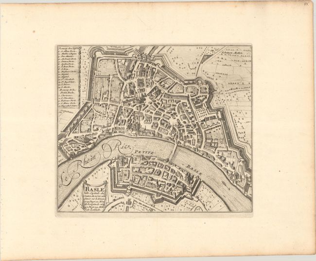
Subject: Basel, Switzerland
Period: 1705 (circa)
Publication:
Color: Black & White
Size:
9.4 x 8 inches
23.9 x 20.3 cm
This intricately engraved bird's-eye plan details the walled city and surrounding countryside. A key at left identifies 20 important buildings and gates. The Rhine is prominently depicted with the historic Middle Bridge spanning across it (although it appears to be partially under construction). North is oriented to the right. Nicolas de Fer held the title of Geographer at Louis XIV's court. He was one of the most prolific publishers of plans of European cities in the late seventeenth century. This map likely appeared in a later edition of his Forces de l'Europe.
References:
Condition: A
A crisp impression on a sheet with wide margins and the watermark of a lion and coat of arms. There are a couple wormholes at top right, well away from map image.