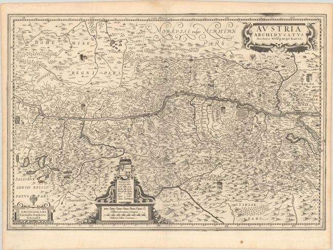
Subject: Eastern Austria
Period: 1631 (circa)
Publication:
Color: Black & White
Size:
20.8 x 14.2 inches
52.8 x 36.1 cm
This striking, rare map of the Danube River valley is based on the cartography of Wolfgang Lazio. Vienna is prominently featured with the Danube river flowing across the center of the map. The map extends south to Graz and west past Linz, but not as far as Salzburg. Numerous tiny villages, cities, mountains, forests and lakes are depicted. Three decorative cartouches grace the map, including a coat of arms. Blank verso. This map is nearly identical to maps published around the same time as Hondius and Blaeu, however this map is from a completely different copperplate.
References:
Condition: B+
A sharp impression on a bright sheet with a bunch of grapes watermark. There are several old manuscript ink notations on verso, two of which show through to the recto on the left side of the image.