Subject: Eastern Europe & Baltic
Period: 1697 (published)
Publication: Introductio in Universam Geographiam
Color: Hand Color
Size:
10 x 8.3 inches
25.4 x 21.1 cm
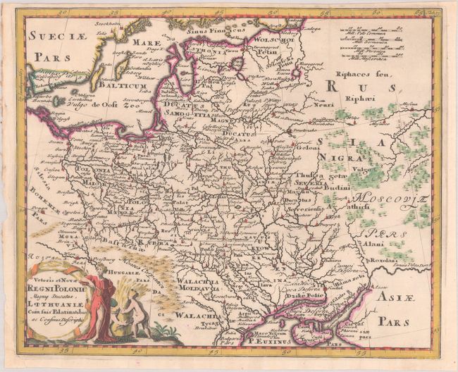
A lovely small map displaying the region from the Baltic to the Black Sea, including the Carpathian Mountains. The map is filled with ancient place names and is adorned with a decorative title cartouche.
Cluver's Introductio in Universam Geographicam was a popular atlas, appearing in over 45 editions during a 100-year period. The first edition was published without maps in the 1620s, and the first edition to include maps was published circa 1641. The various editions were published in different cities throughout Europe, including Amsterdam, Nuremberg, and London. This map is from an Amsterdam edition published by Jan Wolters.
References: Shirley (BL Atlases) T.CLUV-8a #30.
Condition: A
A dark impression, issued folding on a bright sheet with a watermark of the Amsterdam coat of arms. There are archival repairs to a chip at bottom left and a few tiny tears in the bottom margin. The top margin is a bit narrow, as issued.