Subject: Eastern Europe, Lithuania
Period: 1730 (circa)
Publication:
Color: Hand Color
Size:
22.5 x 19.5 inches
57.2 x 49.5 cm
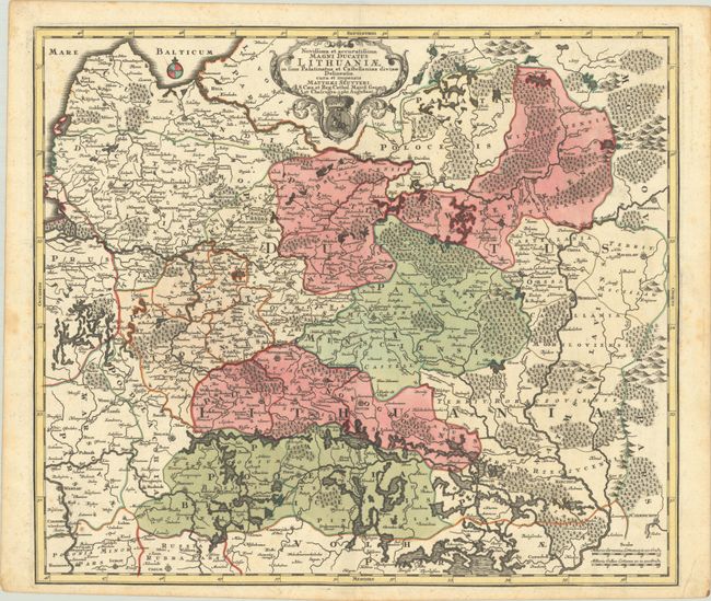
This is the rare first state of Seutter's magnificent map of the Grand Duchy of Lithuania. It was published during the era when the duchy was still part of the vast Polish-Lithuanian Commonwealth. The map covers eastern Poland, Lithuania, Latvia, Belarus, western Russia, and northern Ukraine, spanning from the Gulf of Riga south to Lublin, and from the mouth of the Neman River east to Smolensk. Major cities identified include Warsaw, Bialystok, Kaunas, Vilnius, Riga, Duneburg (Daugavpils), Minsk, Chernihiv, and Chernobyl. Political divisions are delineated, and there is excellent detail of watershed and forests. The ornate strapwork title cartouche incorporates the coat of arms of Lithuania with a knight on horseback holding a sword.
References:
Condition: B+
A sharp impression with full contemporary color on a watermarked sheet. There is light foxing, much of it in the blank margins.