Subject: Barents & White Seas
Period: 1706 (circa)
Publication:
Color: Hand Color
Size:
23.3 x 20.1 inches
59.2 x 51.1 cm
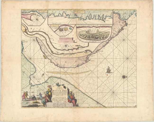
This very uncommon sea chart depicts the southern portion of the Barents Sea leading into the White Sea. The area labeled Laplandt represents the Kola Peninsula, and is largely obscured with 5 insets showing enlarged details of the Kola River, Lombascho, Swetenoes, the northeastern coastline of the Kola Peninsula, and Kildin Island. The map is handsomely adorned with a sailing ship, a decorative title cartouche featuring a bear hunt, and a compass rose orienting North to the right. This is the second state with engraved plate number "33" at bottom right. Printed on two joined sheets, as issued.
References: Koeman, Keu 28 [60]*.
Condition: B
A dark impression on a thick sheet with moderate foxing and soiling. There is a small stain below the ship and light dampstains along the edges of the sheet.