Subject: Yugorsky Strait, Russia
Period: 1662 (circa)
Publication: Atlas Maior
Color: Hand Color
Size:
21.8 x 9.8 inches
55.4 x 24.9 cm
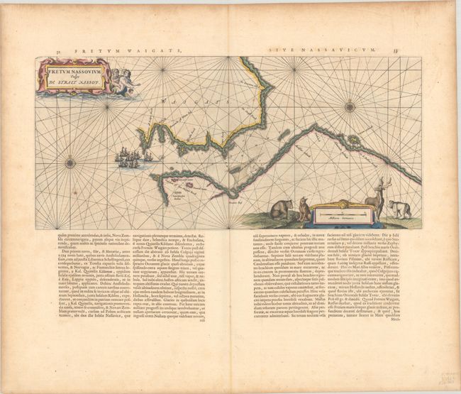
This uncommon map depicts the Yugorsky Strait, which separates Vaygach Island from mainland Russia. Depth soundings, safe anchorages, rocks, and shoals are shown within the strait, with a fleet of galleons about to enter the strait. The map is handsomely adorned with a distance scale flanked by a bear, wolf, moose and polar bear, as well as a title cartouche featuring mer-folk. On a sheet of Latin text measuring 25.9 x 22.0".
References: Van der Krogt (Vol. II) #1272:2.
Condition: B+
A dark impression with full contemporary color with gilt highlights, on a bright sheet with a large watermark of the god Atlas. There is light printer's ink residue, a few spots of foxing in the image, and light toning along the edges of the sheet.