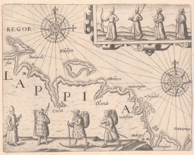
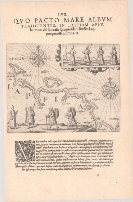
Subject: Lapland, Russia
Period: 1601 (circa)
Publication: Petits Voyages, Part III
Color: Black & White
Size:
6.9 x 5.4 inches
17.5 x 13.7 cm
This copper engraving is from a remarkable series of publications, illustrating voyages of discovery and travels of exploration to various parts of the world. The project was begun by Theodore de Bry of Frankfurt, in 1590 and was to continue for another 54 years. They became known collectively as the Grands Voyages (to America and the West Indies) and the Petits Voyages (to the Orient and the East Indies). De Bry died after the first six parts of the Grands Voyages were completed. The project was completed initially by his widow and two sons, Johann Theodore de Bry and Johann Israel de Bry, then by his son-in-law, Matthaus Merian in 1644.
This small map shows the coast of Russian Lapland (present-day Murmansk Oblast) with the city of Kola. The map is illustrated with several drawings showing the costumes of the native peoples including snow shoes. Two large compass roses capped with fleur-de-lis orient the chart. The engraving was featured in a section on William Barents's expedition from Lapland to the north of Novaya Zemlya in search of a Northeast passage. On a sheet of Latin text measuring 7.9 x 12.1".
References:
Condition: A+
A crisp impression on a watermarked sheet.