Catalog Archive
Auction 202, Lot 536

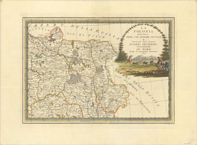
"La Polonia Divisa nelle sue Antiche Province e Delineata Sulle Ultime Osservazioni. Foglio Secondo", Cassini, Giovanni Maria
Subject: Belarus

Period: 1797 (dated)

Publication: Nuovo Atlante Geografico Universale...

Color: Hand Color

Size:
18.9 x 13.2 inches
48 x 33.5 cm
Download High Resolution Image
(or just click on image to launch the Zoom viewer)

This is the northeastern sheet of Cassini's elegantly-engraved, four-sheet map of present-day Poland, Lithuania, Belarus, western Ukraine, and part of Latvia. The northeast sheet covers much of present-day Belarus and extends to include eastern Lithuania and part of southeastern Latvia. It features political divisions, topographical detail, and several towns and cities, most notably Dunaburg (Daugavpils), Vilnius, Hrodna, Minsk, Mohilow (Mogilev), and Vitebsk. The sheet is decorated with a prominent title cartouche depicting a hunting scene in the countryside framed by an arching tree.

References: Phillips (Atlases) #670 Vol. II #68.

Condition: A+

A crisp impression with full contemporary color on a sheet with a Strasburg bend and lily watermark.

Estimate: $200 - $230

Sold for: $100

Closed on 2/12/2025

Archived