Catalog Archive
Auction 202, Lot 546

"Turquie d'Europe et Partie de Celle d'Asie Divisee par Grandes Provinces et Gouvernemts. Dressee sur les Observations Astronomiq.", Janvier/Lattre

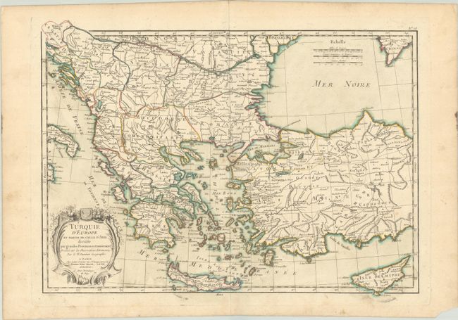
Subject: Balkans & Turkey

Period: 1762 (published)

Publication: Atlas Moderne

Color: Hand Color

Size:
17.3 x 12.5 inches
43.9 x 31.8 cm
Download High Resolution Image
(or just click on image to launch the Zoom viewer)

This finely engraved map is roughly centered on Greece, including the islands of Crete and Cyprus. The map covers the region from Bosnia and Serbia to the Black Sea and Crimea and delineates Croatia, Dalmatia, Macedonia, Bulgaria, and Romania. Decorative shell-style cartouche and three distance scales adorn the map.

References:

Condition: B+

A crisp impression with contemporary color on a watermarked sheet with a bit of printer's ink residue, a couple of small spots in the center of the image, marginal soiling, and small worm tracks in the bottom margin.

Estimate: $110 - $140

Sold for: $60

Closed on 2/12/2025

Archived