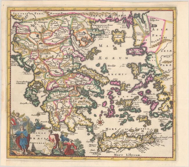
Subject: Greece
Period: 1697 (published)
Publication: Introductio in Universam Geographiam
Color: Hand Color
Size:
10.1 x 9.1 inches
25.7 x 23.1 cm
This attractive small map covers the historic regions of Greece, Crete, and the Aegean Sea. It is filled with detail and adorned with an allegorical title cartouche and a compass rose.
Cluver's Introductio in Universam Geographicam was a popular atlas, appearing in over 45 editions during a 100-year period. The first edition was published without maps in the 1620s, and the first edition to include maps was published circa 1641. The various editions were published in different cities throughout Europe, including Amsterdam, Nuremberg, and London. This map is from an Amsterdam edition published by Jan Wolters.
References: Shirley (BL Atlases) T.CLUV-8a #24; Zacharakis #627.
Condition: A
A dark impression, issued folding on a bright sheet with a watermark of the Amsterdam coat of arms. A binding trim at left has been replaced with old paper, and an adjacent binding tear that just enters the map border has been archivally repaired.