Subject: Eastern Mediterranean & Middle East
Period: 1636 (published)
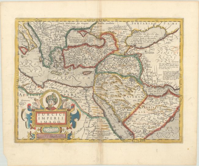
Publication: Gerardi Mercatoris et I. Hondii. Atlas or a Geographicke Description...
Color: Hand Color
Size:
19.3 x 14.3 inches
49 x 36.3 cm
A portrait of Sultan Mehmed II, who conquered Constantinople and brought an end to the Byzantine Empire, tops the title cartouche for this handsome map of the Ottoman Empire. The map extends from the Balkan peninsula through the Caspian Sea in the north and from Northern Africa through the Arabian peninsula in the south. The regions are divided in a similar manner to Ortelius' map of the area. The coastlines of the Red Sea are exaggerated, as are the number and size of the islands. The Red Sea is given four different names: Marre de Mecca, Bohar Corsum, Mare Rubrum and Sinus Arabicus. English text on verso.
References: Ankary #36; Tibbetts #62; Van der Krogt (Vol. I) #8100:1A.
Condition: B+
A nice impression with old color on a watermarked sheet with a bit of color offsetting, light toning along the centerfold, and an archivally repaired centerfold separation that enters 3" into image at bottom. There is a small chip in the bottom left corner of the sheet.