Subject: Eastern Mediterranean & Middle East
Period: 1720 (circa)
Publication:
Color: Hand Color
Size:
22.4 x 19.2 inches
56.9 x 48.8 cm
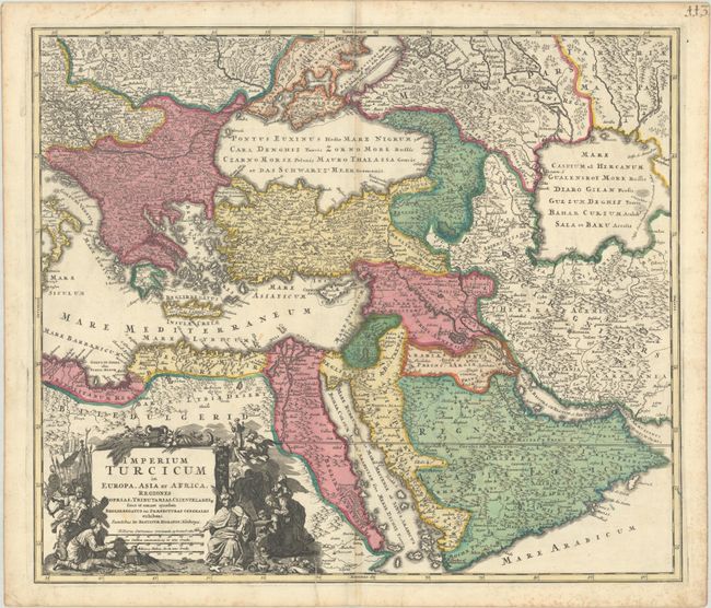
Striking map of the Turkish Empire stretching from the Balkan peninsula to the Caspian Sea and from Egypt through the Arabian peninsula. The elaborate title cartouche is surrounded by figures representing the conquest and the riches of the empire. This map is based on Visscher's map of the region from 1690 (Magni Turcarum Domini Imperium in Europe). Engraved by C. Steinberger. This is Homann's earlier and rarer map of the region, which was replaced with a newly-engraved edition for later atlases.
References: cf. Ankary #160; Tibbetts #175.
Condition: B+
A sharp impression with full contemporary color on a bright, watermarked sheet. There is light toning along the centerfold, scattered foxing along the edges of the sheet, and a few printer's creases adjacent to the centerfold at top and bottom.