Subject: Holy Land
Period: 1729 (published)
Publication:
Color: Hand Color
Size:
17.9 x 13.8 inches
45.5 x 35.1 cm
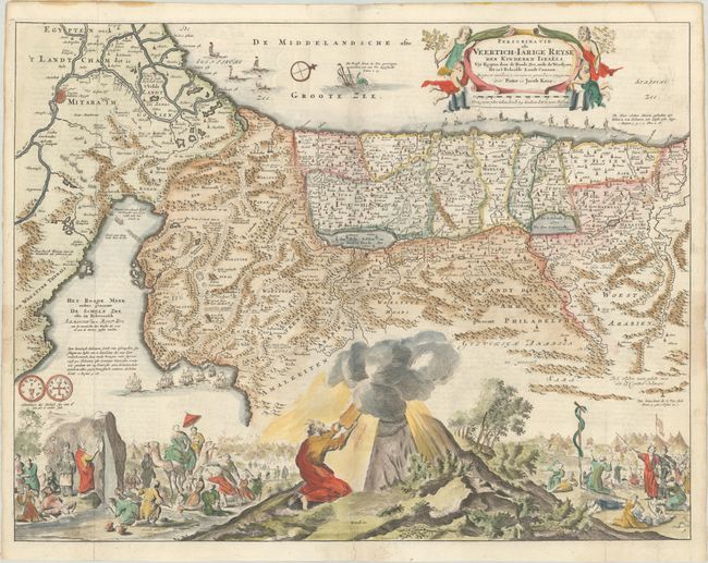
This map depicts the Exodus from Egypt and the wanderings of the Children of Israel. The lower part of the map is elaborately engraved with a scene of the encampment and Moses receiving the Ten Commandments at Mt. Sinai. Adam, Eve, Cane and Abel flank the title cartouche. The map is further decorated with a convoy of ships bringing cedar for the building of Solomon's Temple, and Jonah and the whale. The map was based on Visscher's map of 1650 and originally drawn by Bastiaan Stoopendaal. This is the fourth state with Daniel Stoopendaal's imprint at bottom, and the publisher's imprint, Pieter en Jacob Keur. Dutch text on verso.
References: Poortman & Augusteijn #132-GII-1.
Condition: A
A nice impression, issued folding on a bright sheet with a few printer's creases at left and marginal soiling. There are professional repairs to a few short fold separations, and one of the printer's creases at left has been archivally reinforced on verso.