Subject: Jerusalem, Holy Land
Period: 1604 (circa)
Publication:
Color: Hand Color
Size:
19.5 x 11.5 inches
49.5 x 29.2 cm
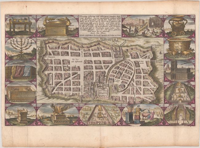
Attractive plan of Jerusalem during Roman times with its well laid out streets and major religious sites within the outer walls. Fifteen vignettes from the Old Testament, primarily Exodus, surround the plan. This is the first state with Plancius' name below the title. Dutch text on verso.
This is the second series of Dutch bible maps by Petrus Plancius, first published in 1604 by Johannes Cloppenburg. The first series consisted of a world map and 4 small maps of the Holy Land and Middle East, engraved by Johannes van Deutecum and his two sons, Johannes and Baptista. After Johannes van Deutecum (the younger) published a new set of maps in 1595, Plancius realized that his own maps required updating. He commissioned Baptista van Deutecum to engrave the second series, who also enlisted the assistance of engravers Daniel van Bremden and Pieter Bast. Plancius' second series retained the same world map and 6 larger, re-engraved maps of the Holy Land and Middle East. The purpose of the maps was to help explain the biblical texts, but Plancius decided to take the maps one step further by adding 15 biblical vignettes surrounding each map, thereby transforming each map into a work of art.
References: Laor #1101; Poortman & Augusteijn #79.
Condition: A
A sharp impression, issued folding with light toning along the edges of the sheet and professional repairs to several separations and short tears all confined to the blank margins.