Subject: Jerusalem, Holy Land
Period: 1702 (circa)
Publication:
Color: Hand Color
Size:
18.1 x 14.1 inches
46 x 35.8 cm
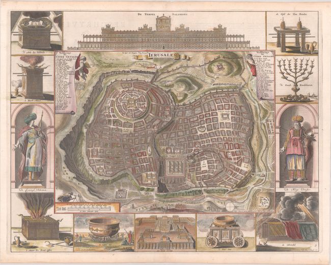
Great bird's-eye plan of the holy city surrounded by engravings of religious icons, Salomon and a High Priest. Reportedly after Vallapando's imaginary city plan, the map was published in a Dutch Bible. At the top is a large and ornate elevation of the Temple of Solomon and at bottom is a plan of the Temple Ezechiels. The map is copied from Nicolas Berchem's 1663 map of Jerusalem. This is the fourth state, with the imprint of Pieter and Jacob Keur below the map. Dutch text on verso.
References: Poortman & Augusteijn #133 GII-1; cf. Laor #1150.
Condition: A
A sharp impression, issued folding on a bright sheet with a short centerfold separation in the top margin that has been professionally repaired, and minor toning along the edges of the sheet.