Subject: Persian Gulf
Period: 1787 (circa)
Publication: Atlas Universel
Color: Hand Color
Size:
12.1 x 8.3 inches
30.7 x 21.1 cm
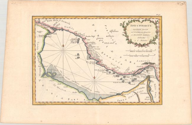
This nicely detailed French map of the Persian Gulf is based on the Carsten Niebuhr map published in Beschryving van Arabie. Along the coasts are various place names, including Basrah, Koueit s: Gran (Kuwait City), Bandar Abbas, and Dsjulfar (Ras Al-Khaimah), with Shiraz and the ruins of Persepolis located farther inland. Several small islands fill the gulf, including Bahhrejn I. The map includes a notable early appearance of Qatar, here called Gattar. A decorative title cartouche adorns the top right corner. The scientific and relatively accurate maps from Niebuhr's travels with the Danish Arabia expedition (1761-67) were highly influential, copied by many top cartographers, including Bonne, Cary, and Lotter.
References: Mickwitz & Miekkavaara #179-92.
Condition: A
A sharp impression with a hint of offsetting and marginal toning.