Subject: Western Hemisphere - America
Period: 1638 (circa)
Publication:
Color: Hand Color
Size:
14 x 10.9 inches
35.6 x 27.7 cm
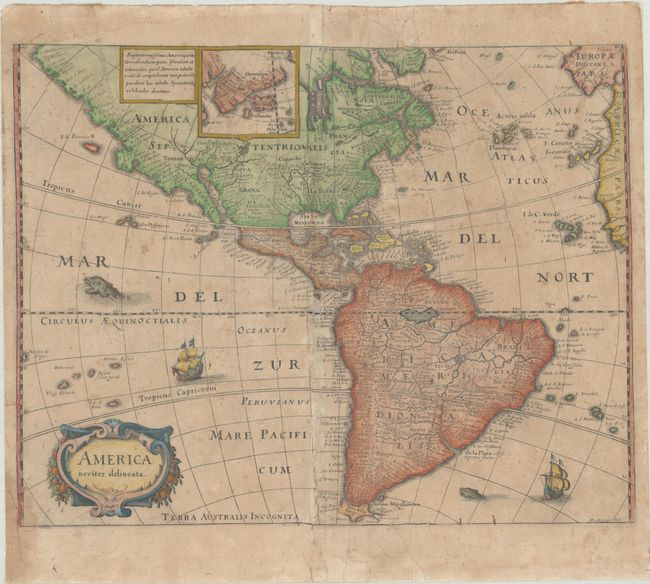
Merian prepared this reduced version of his 1631 map for the German translation of Pierre d'Avity's Les Empires du Monde, and it accompanied other works of the period including Theatrum Europaeum. It is one of the many derivatives of Jodocus Hondius' map of 1618. North America is depicted with a prominent Virginia and an odd New England coastline labeled Norembega. The western coastline above California makes the continent entirely too wide, and there is an odd, dramatic bulge around Mendocino. There is only a hint of the Great Lakes. The mythical Parime Lacus appears in equatorial South America. Greenland, Iceland, and the fictitious Frislandia are shown in a small inset map. Strapwork title cartouche, sea monsters, and Spanish galleons decorate the map. Merian's imprint is located at lower right.
References: Burden #251.
Condition: B
On a toned sheet with a small circle watermark, fully backed with a sheet of old paper, repairing some tears and worm tracks at top of map image and along the centerfold. There are tiny abrasions and small areas of image loss due to the worm tracks, as well as light soiling and dampstaining. On verso are remnants of hinge tape and a tag from previous owner.